>
InfraSolve
InfraSolve road and erosion control design software
InfraSolve® is a powerful, web-based road design and erosion control application developed specifically for engineers working in civil, geotechnical, and environmental disciplines. This comprehensive tool integrates proven design methods with sustainable best practices to design more resilient roadways, channels and stabilized slopes.
Click here to create your login.
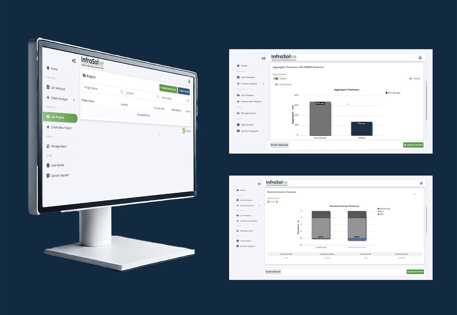
Roadways
InfraSolve offers advanced analysis features for paved and unpaved roadways, utilizing AASHTO Pavement Design or Giroud-Han unpaved design methods.
Engineers can calculate structural performance, compare material options, and optimize cost-effectiveness – all in a user-friendly platform that requires no software download.
Whether you're working on a small-scale parking lot or a complex highway system, InfraSolve enables you to design a cost-effective, geosynthetic solution based on extensive performance research.
Channel and slope stabilization
Design resilient channels and slopes with modules that provide in-depth modeling using HEC-15 analysis for channel protection, and RUSLE analysis for slope protection, while incorporating tested and proven erosion control solutions. InfraSolve expands on traditional erosion control modeling, design, and selection process by integrating nonhydraulic stresses, functional longevity, and performance in critical scenarios for consideration.
These tools provide in-depth modeling of erosion control applications, integrating real product data and design performance across a variety of site-specific conditions.
Integrated solutions for resilient infrastructure
As road and infrastructure projects grow in complexity, engineers face mounting pressure to meet performance, safety, and budget requirements – while also complying with evolving environmental standards. Designing reliable roadways, channels, and slopes is no longer just about structural soundness; it's about anticipating long-term stressors like erosion, water flow, and material performance under varying loads and weather conditions.
Conventional road design software often focuses on basic structural calculations but lacks integrated modeling for real-world conditions like nonhydraulic stresses or functional longevity. At the same time, erosion control remains one of the most under-addressed risks in infrastructure planning, particularly as land use changes, vegetation is removed, and construction activity increases.
Key benefits
Proven design methods: Use AASHTO or Giroud-Han methods for accurate, standards-based roadway analysis
Erosion control design: Model slope and channel protection using HEC-15 and RUSLE, with tested geosynthetic solutions
Optimize maintenance and performance: Reduce trial-and-error and design long-lasting, resilient infrastructure
Built for engineers: Easy-to-use interface with tabulated results, report generation, and personalized support
Web-based convenience: Access anywhere without installation or licensing constraints
Sustainability focused: Aligns with best practices for soil retention, stormwater protection, and reduced environmental impact