Landslide restoration, Langkawi, Kedah, Malaysia

3 Min read

Share

Landslide restoration, Langkawi, Kedah, Malaysia

Overview

Langkawi is an island located around 30 km of the northwestern coast of Peninsular Malaysia. It is a top tourist destination in the country and in June 2006 was accorded Geopark status by UNESCO. Gunung Raya, at 881 m above sea level, is the highest peak in Langkawi. It is accessible right to the top using Federal Route 278, known as Jalan Gunung Raya. The peak houses a museum, a park and a satellite base station, and also offers spectacular panoramic views of the surrounding coastline, especially during sunset. It is a very popular tourist location.

Challenge

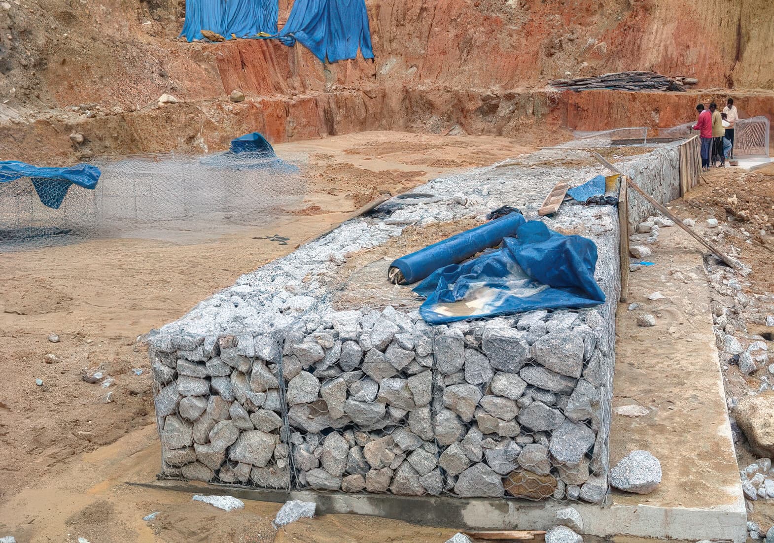
In 2003 after heavy rain a major landslide occurred around the midportion of Jalan Gunung Raya on the upper side of the road. The landslide exposed the granite outcrop and the debris completely cut off the road access. After reviewing several remedial options the decision was made to realign the road away from the failed slope as a permanent solution. The landslide exposed the granite outcrop on the upper side of the road and hence there was no danger of further landslides occurring again in this location. However, precarious parts were trimmed and a gabion debris control structure was constructed to retain the occasional debris flow.

Solution

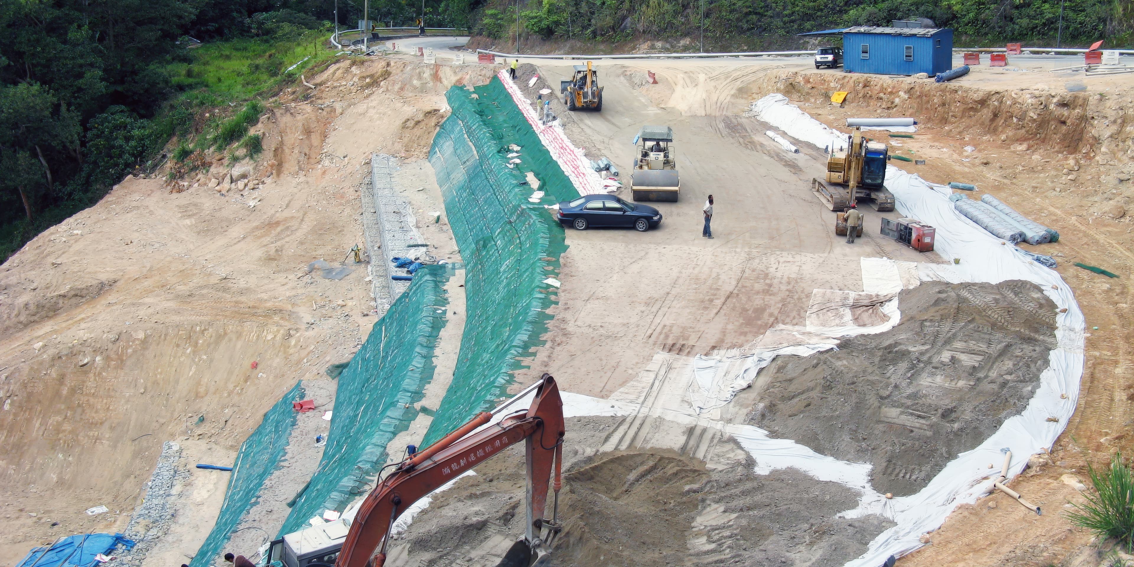
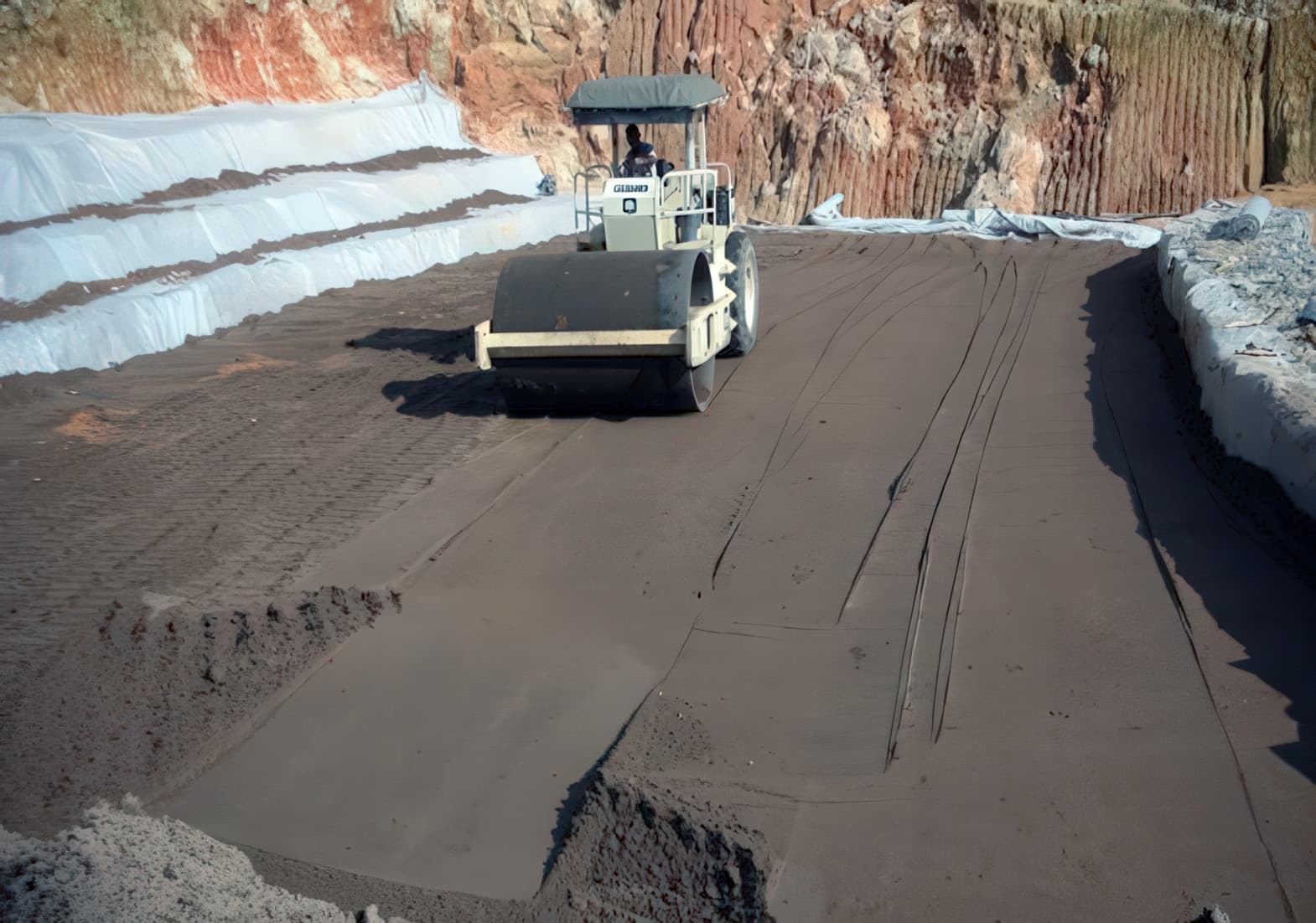
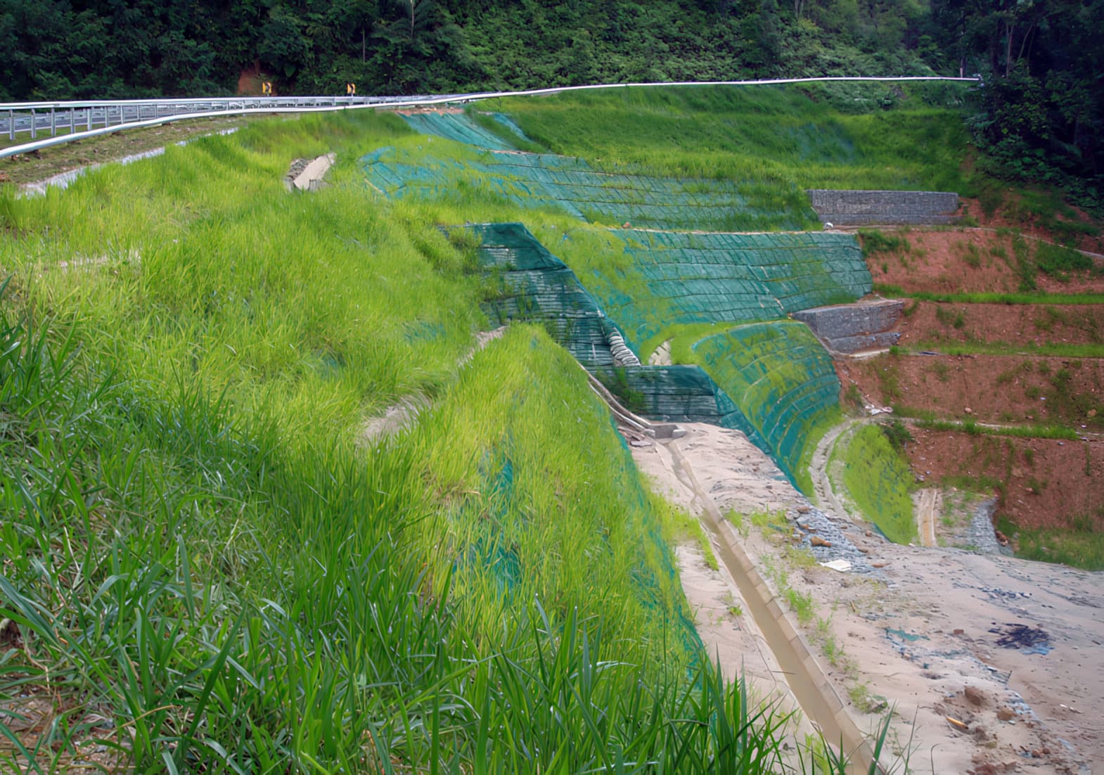
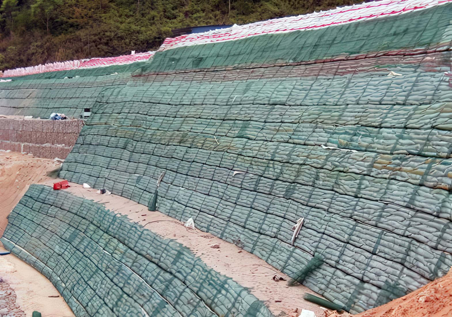
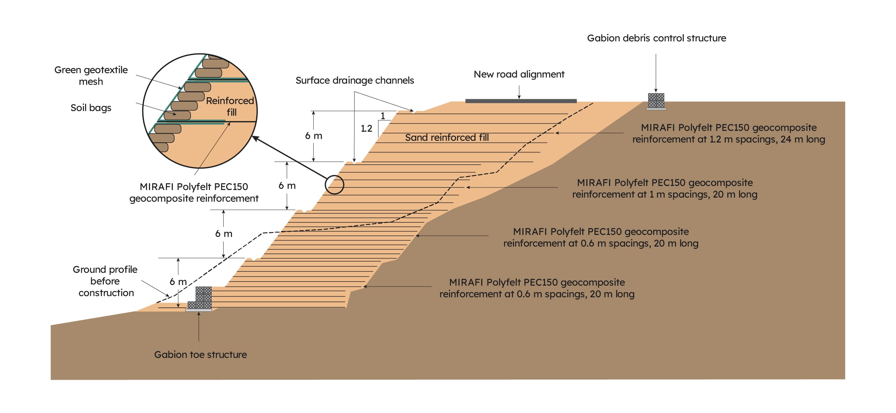
A reinforced fill slope structure was designed to support the realigned road located 30 m away from the original alignment. The reinforced fill slope structure was designed to have a slope facing of 1.2V:1H, built up in 6 m high reinforced soil tiers. At the toe of each tier a surface water catchment drain was located to drain away surface water from the slope face. The landslide debris was removed from the site to clear the road and provide an adequate zone for the new reinforced slope. At the rear of the excavated zone a subsurface drainage layer was provided behind the reinforced soil zone to intercept ground water seepage from the natural strata. A MIRAFI® Polyfelt TS10 geotextile filter was used as the filter for this subsurface drainage layer. At the toe of the slope a low gabion structure is incorporated to enhance toe stiffness. MIRAFI Polyfelt PEC150 geocomposite reinforcement was used to reinforce the fill in the slope. This geocomposite reinforcement has a tensile strength of 150 kN/m. The length of the reinforcement was maintained at a constant 20 m throughout the height of the slope for construction simplicity, except for the upper tier where the reinforcement length was 24 m. The vertical reinforcement spacings varied between 0.6 m and 1.2 m depending on the vertical location in the slope. Soil-filled bags were used as forms to shape the steep slope profile and enable the compactor to work close to the slope face for good compaction of the reinforced fill. These soil bags also fulfill the role of a growing medium for the slope vegetation following completion of the slope construction. Sandy soil from a nearby borrow area was used as the reinforced fill, and this was placed in lifts and compacted using a 10 tonne roller to achieve a minimum of 90% of standard Proctor density. A green colored geotextile mesh was used as a wrap-around (around the soil-filled bags) on the slope surface. This geotextile mesh reinforces the root matter of the slope vegetation and prevents surface erosion. Once construction of the reinforced slope had been completed, hydroseeding was carried out to establish surface vegetation. It only took several weeks for the surface vegetation to become fully established.


Explore more case studies

View all